Kujataa (Sydgrønland)
60°08,338'N 045°14,314'W - Kort 1133 - havneplanskort 1150
Kujataa (South Greenland)
60°08,338'N 045°14,314'W - Chart 1133 - harbourplan chart 1150
By
1088 indbyggere (2026)
City
1088 inhabitants (2026)
der ejes af Grønlands Selvstyre og administreres af Royal Arctic Line, er beliggende i en S-vendt vig på E-siden af øen af samme navn og består af:
1. Qujanartup Qinngua (Kirkegårdsbugten) med følgende kajanlæg:
Skonnertkaj: Kajlængde 10 m/ Dybde 1) 3,6 m/ Bolværkshøjde 2) 1,0 m.
Fiskerikaj: Kajlængde 20 m/ Dybde 1) 3,6 m (nokken)/ Bolværkshøjde 2) 1,5/ Belastning 2000 kg/m².
Atlantkaj: Kajlængde 30 m/ Dybde 1) 7,3 m/ Belastning 2000 kg/m².
Fiskerikaj N: Kajlængde 20 m/ Dybde 1) 1,4 m/ Bolværkshøjde 2) 1,5 m.
Bundforhold: Ved Skonnertkaj: Klippe/mudder. Ved Fiskerikaj: Klippe/sten.
2. I bugten Illorsuup Qinngua findes følgende kajanlæg for mindre fartøjer og både:
Liggepier: Kajlængde ca. 6 m/ Dybde 1) 1,5 m/ Bolværkshøjde 2) 1,0 m.
Bundforhold: Klippe/mudder.
3. Agterfortøjning ud for tankanlægget på næsset Tupertalik NE for byen. Dybde 10 m. Desuden findes en afmærket ankerplads med en dybde på 26-30 m.
Bundforhold: Klippe.
4. Kajanlæg for mindre fartøjer og både på W-siden af næsset Ivannguit ved bugten Tunuliariteq NE for byen:
Anløbskaj: Kajlængde ca. 6 m/ Dybde 1) ca. 1,5 m/ Bolværkshøjde 2) ca. 1,0 m.
Bundforhold: Klippe.
1) middelspringtidslavvande, 2) middelhøjvande.
Små skibe på indtil 1000 tons og en dybgang på indtil 3,6 m kan ligge ved Skonnert- og Fiskerikaj. Både og mindre fartøjer kan fortøje ved Liggepier eller Anløbskaj N for byen.
Middeltemperatur: Forår: -0,5ºC; sommer: +5,5ºC; efterår: +1ºC; vinter: -5ºC.
Nanortalik betyder på grønlandsk (stedet med isbjørne).
Se havneplan.
langs Skonnertkaj: Længde 60 m, dybgang ca. 4 m.
Ved Atlantkaj: Længde 110 m, bredde 22 m, dybgang 7 m. Under ekstreme vindforhold (passage af dybe lavtryk og SE-lig kuling og storm) anbefales, at kajen ikke anløbes med større dybgang end ca. 5,7 m.
Flodhøjde ved springtid ca. 3,0 m, ved niptid ca. 1,5 m. Under Sydosten og stærke fjeldkast ved lavtrykspassager kan vanddybden i havnen være under daglig vande. Maks. flodhøjde ca. 3,5 m.
Ved stigende vande sætter tidevandsstrømmen ENE-over med ca. 1-2 knob gennem sundet Nuup Ikera S for byen for at dreje N-over i Qujanartup Qinngua (Kirkegårdsbugten). Tidevandsstrømmen sætter modsat ved faldende vande. I anduvningen til Nanortalik løber tidevandsstrøm og idvande ved øerne og ledefyrlinjerne med op til 2 knob.
Isfri anløbsperiode: Primo august - primo maj.
I storisperioden bør DMI's Istjeneste altid kontaktes. Storisen, kan, især ved samspil mellem strømforhold og S-lige vinde, genere besejlingen af Nanortalik fra primo januar til ultimo juli. De hyppige Sydosten og kraftige fjeldkast i vinterperioden bevirker, at havnen ikke lægger til med vinteris i en sådan grad, at anløb af havnen generes heraf.
Stærke lokale fjeldkast kan forekomme og kan især i efterårs- og vinterperioden opnå orkanagtig styrke. Lavtrykspassage i området forårsager kraftige fjordvinde eller Sydosten.
forekommer ofte i storisperioden. S- og SE-lig vind giver ofte nedsat sigtbarhed og nedbør.
Havnen kan besejles både dag og nat. Store skibe dog kun efter aftale med havnemyndighederne.
Anløbsforhold og ankring:
ETA afgives med 24 timers varsel. Anduvningen er angivet ved ledefyr med dagmærker (trekanter). Ved anløb stiller havnen rutineret trossehold til rådighed for store skibe ved anløb af Atlantkaj. Skonnertkaj skal på grund af dennes konstruktion anløbes med forsigtighed.
Ved vindstyrke kraftigere end frisk vind og/eller hvis der står dønning i havnevigen bør man afvente vejrbredring før anløb af Atlantkaj.
Store skibe kan normalt under gunstige vind- og vejrforhold ankre i Qujanartup Qinngua. Ved vind fra SE bør ankring i bugten undgås.
Havnen er ikke sikker liggeplads for store skibe, dette gælder især under lavtrykspassager, hvorfor havnen må forlades betids ved opkommende kraftige fjeldkast eller Sydosten, og det anbefales at holde gående i Tasermiut for afventning af vejrbedring.
Dagens længde (ca. tider):
Korteste dag: 0900-1500.
Længste dag: 0200-2300.
Største tilladte fart er 3 knob eller sikker styrefart.
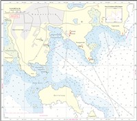
Se kort og havneplan.
Se kort og havneplan.
SW for Skonnertkaj ligger rørledninger ud for frysepakhuset.
Nødankerpladser: Store skibe kan ankre i Qassit ca. 3 sm NE for Nanortalik. Dybden på ankerpladsen er 40-50 m. Da holdebunden er mindre god og kraftige fjeldkast kan forekomme på denne ankerplads, er det sikrest ved opkommende dårligt vejr at holde gående i Tasermiut. Små skibe kan ankre på ca. 13 m vand i lerbund på N-siden af Aakkat ca. 1,5 sm NNE for Nanortalik eller ca. 0,1 sm W for Anarusuk, men kendtmand må benyttes. Disse ankerpladser benyttes især, når storisen med S-lige vinde blokerer indsejlingen til Nanortalik.
Ferskvand leveres pr. tankvogn med 6 ton ad gangen. Gasolie kun i mindre mængder til anløbende skibe. Flaskegas. Møntvaskeri. Bådeværft med ophalerbedding af både på indtil 10 tons.
Losse- og lastegrej:
Havnen råder over diverse materiel til container- og godshåndtering.
Sundhedsvæsen:
Sundhedscenter med læge og sygeplejersker samt apotekervarer. Mulighed for anskaffelse og supplering af "medicinkiste".
Royal Arctic Line
Telefon (+299) 49 01 44 (døgnvagt)
Telefon (+299) 61 34 33
Telefax (+299) 61 34 32
E-post: brje@ral.gl
VHF (Indenfor normal arbejdstid kan havnekontoret kontaktes på kanal 16)
Nanortalik Tele-Post Center
Standardordensreglement er gældende.
Naalakkersuisut er central overordnet havne- og ISPS myndighed i Grønland. Royal Arctic Line er lokal funktionel havnemyndighed og ISPS ansvarlig for havnefaciliteter i Nanortalik.
The harbour is owned by the Government of Greenland and is administered by Royal Arctic Line. It is located in a S-facing cove on the E side of the island of the same name and consists of:
1. Qujanartup Qinngua (Kirkegårdsbugten) with the following quay facilities:
Skonnertkaj: Quay length 10 m/depth 1) 3.6 m/wharf height 2) 1.0 m.
Fiskerikaj: Quay length 20 m/depth 1) 3.6 m (pierhead)/wharf height 2) 1.5 m/load 2,000 kg/m2.
Atlantkaj: Quay length 30 m/depth 1) 7.3 m/load 2,000 kg/m².
Fiskerikaj N: Quay length 20 m/depth 1) 1.4 m/wharf height 2) 1.5 m.
Seabed conditions: At Skonnertkaj: Rock/mud. At Fiskerikaj: Rock/stone.
2. The following quay facilities are available for small vessels and boats in Illorsuup Qinngua bay:
Liggepier: Quay length approx. 6 m/depth 1) 1.5 m/wharf height 2) 1.0 m.
Seabed conditions: Rock/mud.
3. Stern-mooring off the tank facility at the headland of Tupertalik NE of the town. Depth 10 m. There is also a marked anchorage with a depth of 26-30 m.
Seabed conditions: Rock.
4. Quay facility for small vessels and boats on the W side of the headland of Ivannguit at the bay of Tunuliariteq, NE of the town:
Anløbskaj: Quay length approx. 6 m/ Depth 1) approx. 1.5 m/ Wharf height 2) approx. 1.0 m.
Seabed conditions: Rock.
1) Mean low water spring, 2) Mean high tide.
Small ships of up to 1000 tonnes and with a draught of up to 3.6 m can moor at Skonnertkaj and Fiskerikaj. Boats and smaller vessels can moor at Liggepier or Anløbskaj N of the town.
Mean temperature: Spring: -0.5 °C; summer: +5.5 °C; autumn: +1 °C; winter: -5 °C.
In Greenlandic, Nanortalik means "the place with polar bears".
Refer to the harbour plan.
Along Skonnertkaj: Length 60 m, draught approx. 4 m.
At Atlantkaj: Length 110 m, width 22 m, draught 7 m. It is not recommended to approach the quay with draught greater than approx. 5.7 m during extreme wind conditions (passing of deep low pressure systems and SE gales and storms).
Tidal range at spring tide approx. 3.0 m, at neap tide approx. 1.5 m. During a Southeaster and strong mountain gusts in connection with passing depressions, the water depth in the harbour may be below mean sea level. Max. tidal range approx. 3.5 m.
With rising tides, the tidal current flows ENE at approx. 1-2 knots through the sound Nuup Ikera, S of the town, and then turns N in Qujanartup Qinngua (Kirkegårdsbugten). The tidal current flows in the opposite direction with a falling tide. In the approach to Nanortalik, tidal currents and coastal countercurrents flow near the islands and the leading lights at a rate of up to 2 knots.
Ice-free approach period: Early August - early May.
The DMI Iceservice should always be contacted during the polar ice season. The polar ice, especially when interacting with current conditions and S winds, can hamper navigation of Nanortalik between early January and the end of July. The frequent Southeasters and strong mountain gusts during the winter mean that the harbour is not covered by winter ice to such an extent that it prevents calling at the harbour.
Strong local mountain gusts can occur and reach hurricane-like strength, particularly during the autumn and winter periods. A passing depression in the area causes strong fjord winds or a Southeaster.
Fog often occurs during the polar ice season. S and SE winds often result in precipitation and reduced visibility.
The harbour can be navigated during both the day and night. Large ships, however, only by agreement with the harbour authorities.
Approach conditions and anchoring:
ETA should be notified with 24 hours' notice. The approach is indicated by leading lights with beacons (triangles). The harbour provides an experienced hawser team for large ships calling at Atlantkaj. Due to its design, Skonnertkaj must be approached with caution.
If the wind is stronger than a fresh breeze and/or if there is a swell in the cove, ships should await improved weather conditions before approaching Atlantkaj.
Under favourable wind and weather conditions, large ships can usually anchor in Qujanartup Qinngua. Anchoring in the cove should be avoided when the wind is from the SE.
The harbour is not a safe berth for large ships. This is especially true during passing depressions, and the harbour must therefore be vacated in good time before mountain gusts or Southeasters occur. It is recommended to await better weather in Tasermiut.
Length of the day (approx. times):
Shortest day: 09:00-15:00.
Longest day: 02:00-23:00.
The maximum speed permitted is 3 knots or safe manoeuvre speed.
Refer to the chart and harbour plan.
Refer to the chart and harbour plan.
Emergency anchorages: Large ships can anchor in Qassit, approx. 3 M NE of Nanortalik. The depth at the anchorage is 40-50 m. Since the holding ground at the anchorage is less than good and strong mountain gusts can occur, it is safest to await better weather in Tasermiut when bad weather is approaching. Small ships can anchor in approx. 13 m of water on a clay bottom on the N-side of Aakkat, approx. 1.5 M NNE of Nanortalik or approx. 0.1 M W of Anarusuk, but a guide Kendtmand must be used. These anchorages are used especially when S winds cause the polar ice to block the entrance to Nanortalik.
Fresh water is delivered by tanker truck, 6 tonnes at a time. Gas oil is only available in smaller quantities for arriving ships. Bottled gas. Laundromat. Boat yard with slipway for boats up to 10 tonnes.
Loading and unloading gear:
The harbour has various equipment available for container and freight handling.
Health service:
Health centre with doctor and nurses and pharmacy products. Possibility of procurement and supplementation of "medicine chest".
Royal Arctic Line
Telephone (+299) 49 01 44 (24-hour service)
Telephone (+299) 61 34 33
Telefax (+299) 61 34 32
E-mail: brje@ral.gl
VHF (The harbour office can be contacted on channel 16 during normal working hours)
Nanortalik Tele-Post Center