Kitaa (Vestgrønland)
61°59,696'N 049°40,566'W - Kort 1230 - havneplanskort 1250
Kitaa (West Greenland)
61°59,696'N 049°40,566'W - Chart 1230 - harbourplan chart 1250
By
1205 indbyggere (2026)
City
1205 inhabitants (2026)
Indtil videre er båken 354 på Kangeq Kujalleq ødelagt.
Until further notice beacon 354 on Kangeq Kujalleq is destroyed.
der ejes af Grønlands Selvstyre og administreres af Royal Arctic Line, ligger inderst i en vig, der er åben mod SW ud til et smalt sund, dannet af ø-grupper på hver side. Der findes følgende kajanlæg:
Atlantkaj: Kajlængde 90 m/ Dybde 1) 7,8-8,6 m/ Bolværkshøjde 2) 2 m/ Belastning 2000 kg/m².
Trawlerkaj: Kajlængde 50 m/ Dybde 1) 3,5-4,0 m/ Bolværkshøjde 2) 2 m.
Fiskerikaj: Kajlængde 60 m/ Dybde 1) 2,5 m/ Bolværkshøjde 2) 2 m.
Liggekaj: Kajlængde 65 m/ Dybde 1) 3,6 m/ Bolværkshøjde 2) 2 m.
Tankbrohoved: Kajlængde 10 m/ Dybde 1) 2,5-5,0 m/ Bolværkshøjde 2) 2 m.
Monteringskaj: Kajlængde ca. 6,5 m/ Dybde 1) ca. 5,0 m/ Bolværkshøjde 2) ca. 1,5 m.
Optagningskaj: Kajlængde 5 m/ Dybde 1) ca. 2,5 m.
Gl. Pramsted: Kajlængde 30 m.
Flere pontonbroer i vigen S for Atlantkaj og 2 pontonbroer i vigen N for bådeværftet.
Bundforhold: Havn: Klippe/mudder.
1) middelspringtidslavvande, 2) middelhøjvande.
Paamiut betyder på grønlandsk (stederne ved udmundingen).
Se havneplan.
langs Atlantkaj: Længde 110 m, bredde 18 m, dybgang 7,0 m.
Flodhøjde ved springtid ca. 3,8 m, ved niptid ca. 2,0 m. Maks. flodhøjde ca. 4,2 m.
I mundingen af Kuannersooq (Kvanefjord) og ved Qernertuunguaq (Sorte Skær) er W-gående strøm med 1-2 knob. I indsejlingen tværs af Oqaatsorsuit (Skarvø) sætter strømmen SE-over, stærkest ved N-lig kuling. Tidevandet i havnen sætter svagt med ca. 1 knob. Der er strømskel ved Saattuarsussuaq og som oftest strømsø.
Isfri anløbsperiode: Primo august - januar.
DMI's Istjeneste bør altid (hele året) kontaktes forud for anløb. Storisen når ofte N-over til ud for Paamiut og kan efter ekstremt kolde vintre ligge længere N-over til ud for Orsiivik (Polaroil). Sædvanligvis er der landvand mellem storisen og kysten, således storisen kan omsejles N om. Efter normale vintre er havnen isfri fra slutningen af august til marts/april. I øvrigt gives der somre, hvor storisen ikke hindrer anløb. Mindre isforekomster kan dog på et sent stadium af storisens drift være til gene, idet den spærrer havnen og kysten et stykke N-efter. SW- og SE-lige vinde sætter storisen på land, mens NW/NE-lige vinde sammen med Den vestgrønlandske Strøm, der er S-gående, skaber landvand. Ved SW-lige vinde under storisperioder strander skosser ofte i havneindsejlingen. Ligeledes kan havnevigene i samme periode ved springtid fyldes med kalv- og bræis. Isbræen i Sermilik sætter blåis ud for Kangilernup Sermilikasia (Kvanefjord) og Narsalik samt så langt til søs som 9-12 sm af kysten. I ekstremt kolde vintre ligger vinterisen i havnevigene fra ultimo januar til primo marts og er da målt til en tykkelse af 35-47 cm.
Ved havnen er der alene læ for N-lige vinde. SW-lig kuling står ret ind mod kajanlæggene, hvor den sætter en svær dønning. Sydosten blæser voldsomt fjordret og med særlig kraft ved vintertid.
forekommer ofte om foråret og i storisperioden. S-lige fønvinde giver nedbør og ringe sigtbarhed. I øvrigt har bygden på grund af beliggenheden tæt ud til havet et temmelig råt og fugtigt klima.
Havnen kan besejles både dag og nat.
Anløbsforhold og ankring:
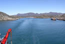
ETA gives med 24 timers varsel. Anduvningen er angivet med ledefyr. Et godt pejlemærke ved anduvningen af havnen er vraget af "Greenland Star", som ligger på skæret ved W-siden af øen Allerillat. Holdebunden er dårlig. Havnen, der er åben mod SW, kan ikke anses for sikker at anløbe under kraftig SW-lig kuling samt under Sydosten. Især under SW-lig kuling kan dønning ofte stå voldsomt ind i havnen. Under sådanne forhold må der derfor ofte holdes gående i fjordene S for byen for afventning af vejrbedring.
Dagens længde (ca. tider):
Korteste dag: 0900-1500.
Længste dag: 0200-2300.
Største tilladte fart er 3 knob eller sikker styrefart.
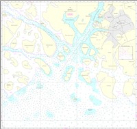
Se kort og havneplan.
Se kort og havneplan.
Se havneplan.
Nødankerplads:
Der ankres i Eqaluit ca. 200 m fra land. Holdebunden er god, og der er læ ved vinde fra NW til NE.
Ferskvand leveres pr. tankvogn ved Atlantkaj eller via slange. Gasolie leveres kun efter forudgående aftale med havnemyndighederne. Proviant kan fås i rimeligt omfang.
Elforsyning: Ved NW-enden af Atlantkaj og ved Trawlerkaj og alene for fartøjer hjemmehørende i havnen.
Kompasretning: Imarsiornermik Ilinniarfik (Grønlands Maritime Center), Paamiut afdeling.
Losse- og lastegrej:
Havnen råder over diverse materiel til container- og godshåndtering.
Sundhedsvæsen:
Sundhedscenter med læge og sygeplejersker samt apotekervarer.
Transport:
Der er lufthavn, hvorfra der er forbindelse til Nuuk og Narsarsuaq.
Royal Arctic Line
Mobiltelefon (+299) 49 84 98 (døgnvagt)
E-post: nipe@ral.gl
VHF (Indenfor normal arbejdstid kan havnen kontaktes på kanal 16)
Paamiut Tele-Post Center
Standardordensreglement er gældende.
Naalakkersuisut er central overordnet havne- og ISPS myndighed i Grønland. Royal Arctic Line er lokal funktionel havnemyndighed og ISPS ansvarlig for havnefaciliteter i Paamiut (Frederikshåb).
The harbour is owned by the Government of Greenland and is administered by Royal Arctic Line. It lies in the innermost part of a cove, which is open to the SW, out towards a narrow sound formed by groups of islands on each side. There are the following quay facilities:
Atlantkaj: Quay length 90 m/depth 1) 7.8-8.6 m/wharf height 2) 2 m/load 2,000 kg/m2.
Trawlerkaj: Quay length 50 m/depth 1) 3.5-4.0 m/wharf height 2) 2 m.
Fiskerikaj: Quay length 60 m/depth 1) 2.5 m/wharf height 2) 2 m.
Liggekaj: Quay length 65 m/depth 1) 3.6 m/wharf height 2) 2 m.
Tankbrohoved: Quay length 10 m/depth 1) 2.5-5.0 m/wharf height 2) 2 m.
Monteringskaj: Quay length approx. 6.5 m/depth 1) approx. 5.0 m/wharf height 2) approx. 1.5 m.
Optagningskaj: Quay length 5 m/depth 1) approx. 2.5 m.
Gl. Pramsted: Quay length 30 m.
Several pontoon bridges in the cove S of Atlantkaj and 2 pontoon bridges in the cove N of the boat yard.
Seabed conditions: Harbour: Rock/mud.
1) Mean low water spring, 2) Mean high tide.
Paamiut means "the places at the mouth" in Greenlandic.
Refer to the harbour plan.
Along Atlantkaj: Length 110 m, width 18 m, draught 7.0 m.
Tidal range at spring tide is approx. 3.8 m and at neap tide approx. 2.0 m. Max. tidal range approx. 4.2 m.
There is a W current of 1-2 knots in the mouth of Kuannersooq (Kvanefjord) and at Qernertuunguaq (Sorte Skær). In the entrance across Oqaatsorsuit (Skarvø), the current flows SE and is strongest in a N gale. The tide in the harbour flows at approx. 1 knot. At Saattuarsussuaq there are usually tide rips.
Ice-free approach period: Early August - January.
The DMI Ice Service should always be contacted (throughout the year) prior to calling. The polar ice often extends N as far as to outside Paamiut and after extremely cold winters, it can extend further N to off Orsiivik (Polaroil). There is usually shore lead between the polar ice and the coast, so that it is possible to navigate N around the polar ice. After a normal winter, the harbour is free of ice from the end of August until March/April. In some summers, the polar ice does not impede approach. However, small quantities of ice can cause inconvenience at a late stage of the drifting of the polar ice, by blocking the harbour and the coast a short distance northwards. SW and SE winds blow the polar ice onto the coast, while NW/NE winds combined with the West Greenland current, which flows S, create shore lead. SW winds during polar ice periods often cause floes to strand in the harbour entrance. Similarly, spring tides during the same period can cause the cove to fill with calf ice and glacial ice. The glacier in Sermilik produces blue ice outside Kangilernup Sermilikasia (Kvanefjord) and Narsalik and as far out to sea as 9-12 M from the coast. In extremely cold winters, the winter ice remains in the cove from the end of January to the beginning of March, when it has been measured with thickness of 35-47 cm.
The harbour only provides shelter from N winds. SW gales blow straight in against the piers, where it produces a heavy swell. Southeasters blow strongly, straight through the fjord and with extra force during winter.
Fog often occurs during spring and in the polar ice season. S Foehn winds produce precipitation and poor visibility. Due to its position close to the sea, the settlement has a rather rough and humid climate.
The harbour can be navigated during both the day and night.
Approach conditions and anchoring:
ETA should be notified with 24 hours notice. The approach is marked with leading lights. A good landmark when approaching the harbour is the wreck of "Greenland Star", which lies on the rocks on the W side of the island of Allerillat. The holding ground is poor. The harbour, which is open to SW, cannot be considered safe to approach in a heavy SW gale or a Southeaster. A violent swell can often enter the harbour, especially during a SW gale. Under such conditions, therefore, it is often necessary to await better weather in the fjords S of the town.
Length of the day (approx. times):
Shortest day: 09:00-15:00.
Longest day: 02:00-23:00.
The maximum speed permitted is 3 knots or safe manoeuvre speed.
Refer to the chart and harbour plan.
Refer to the chart and harbour plan.
Emergency anchorage:
It is possible to anchor in Eqaluit, 200 m from land. The holding ground is good and there is shelter from winds from NW to NE.
Fresh water is delivered by tanker truck at Atlantkaj or by hose. Gas oil is only supplied by prior agreement with the harbour authorities. Provisions can be obtained in reasonable quantities.
Electricity supply: At the NW end of Atlantkaj and at Trawlerkaj, but only for vessels based in the harbour.
Compass adjustment: Imarsiornikik Ilinniarfik (Greenland's Maritime Centre), Paamiut department.
Loading and unloading gear:
The harbour has various equipment available for container and freight handling.
Health service:
Health centre with doctor and nurses and pharmacy products.
Transport:
There is an airport with connections to Nuuk and Narsarsuaq.
Royal Arctic Line
Mobile telephone (+299) 49 84 98 (24-hour service)
E-mail: nipe@ral.gl
VHF (The harbour can be contacted on channel 16 during normal working hours)
Paamiut Tele-Post Center