Kitaa (Vestgrønland)
66°58,086'N 050°56,929'W - Kort 1400 - havneplanskort 1411
Kitaa (West Greenland)
66°58,086'N 050°56,929'W - Chart 1400 - harbourplan chart 1411
Bygd
381 indbyggere (2026)
Settlement
381 inhabitants (2026)
Indtil videre er der etableret en sejlrende med minimumsdybde på 3,5 m MV umiddelbart E for båkelinjen. I basinnet foran havnen er der uddybet til 5,0 m MV.
A fairway with a minimum depth of 3.5 m (MV) has been established E of the leading line.
In the basin in front of the harbour, the depth has been increased to 5.0m (MV).
der ejes af Grønlands Selvstyre og administreres af Sikuki A/S består af en S-vendt bugt i bunden af Kangerlussuaq (Søndre Strømfjord) mellem Brennan Pynt og Emmons Pynt med kajanlæg, søterminal for tankskibe og ankerplads.
Broanlæg: Kajlængde 20 m/ Dybde 1) ca. 1,5 m/ Bolværkshøjde 2) ca. 1,5 m.
Søterminal for tankskibe med dybder på:
24-26 m 1) på S-siden af fortøjningssted.
ca. 15 m 1) på selve fortøjningssted.
ca. 10 m 1) på N-siden af fortøjningssted.
Fortøjningstønde forankret på ca. 60 m vand.
Bundforhold: Ler.
1) middelspringtidslavvande, 2) middelhøjvande.
Kangerlussuaq betyder på grønlandsk (den store fjord).
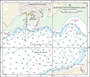
Se havneplan.
Ved broanlægget: Kun mindre fartøjer fra opankrede skibe, små landgangsfartøjer samt fritidsbåde kan anløbe via den gravede og afmærkede rende (vanddybde ca. 3,0 m ved middelvandstand, MSL). Renden er oprenset i 2016. Det må påregnes, at dybden aftager med ca. 0,25 m pr. år. Oprensning finder normalt sted med intervaller på 5-6 år
Flodhøjde ved springtid ca. 3, 0 m, ved niptid ca. 1,6 m. Maks. flodhøjde ca. 3,6 m. Der er højvande i Kangerlussuaq inderste og E-lige del ca. 3 timer senere end ved mundingen. Se i øvrigt Tidevandstabeller for Grønland.
Strømmen i indløbet og i den W-lige del af Kangerlussuaq (Søndre Strømfjord) er NE-gående ved stigende vande og SW-gående ved faldende vande, og kan i denne del af fjorden opnå en fart af 7 knob. Ca. 20 sm E-ligere i fjorden aftager strømmen til maksimalt ca. 3 knob og ved Qaqqatsiaq (midtvejs i fjorden) til ca. 2 knob. Strømmen kan mærkes indtil ca. 60 sm E for indløbet. Uden for indløbet til fjorden er der stærk strøm på tværs af fjordens munding - som regel N-gående - hvilket må tages i betragtning ved anduvning.
Isfri anløbsperiode: Medio juni - ultimo oktober, i hvilken periode havnen kan besejles både dag og nat.
Kangerlussuaq (Søndre Strømfjord) lægger til med vinteris i hele den inderste E-lige halvdel indtil ca. 55 sm SW for Kangerlussuup Umiarsualivia, der må påregnes at være lukket for besejling fra primo december til medio juni. Vinterisens tykkelse kan være fra 5 cm til 90 cm. Gennemsnitstykkelsen er ca. 45 cm. Den tykkeste is findes som regel i fjordens S-side. Om vinteren og om foråret fører tidevandet en del is fra søen ind i den SW-lige del af fjorden.
Vejret i Kangerlussuup Umiarsualivia er normalt bedst fra juli - oktober og er sædvanligvis ingen hindring for ekspedition af skibene. Stærke vinde kan forekomme fra indlandsisen fra retninger mellem E og SE.
forekommer sjældent og nedbøren er ringe. Området har gennemsnitlig ca. 10 tågedage om året. Lav kysttåge kan om sommeren ligge helt ind til mundingen af fjorden.
Anløbsforhold og ankring: ETA afgives med 24 timers varsel for store skibes vedkommende. Tankskibe fortøjer til tønder ved søterminalen ca. 700 m SSE for Emmons Pynt. Holdebunden er god og består af mudder og ler.
Dagens længde (ca. tider):
Mørketid: 16.-27. december.
Midnatssol: 15. juni - 1. juli.
5 knob under sejlads i havnen.
Er indfaldsporten til Grønland med fly.
Bygden bliver forsynet med 2 til 3 anløb af atlantskib, og et ugentlig anløb af bygdefartøj fra Sisimiut.
Se kort og havneplan.
Se kort og havneplan.
Se kort 1411.
Se kort 1411.
Der findes motorbåd og 2 LCM landgangsfartøjer.
Ferskvand, gasolie og proviant kan ikke påregnes.
Losse- og lastegrej:
Mobile kraner med løfteevne på op til 5 tons og trucks. Landgangsfartøjer til losning og lastning af skibe, der ligger til fortøjningstønde eller til ankers.
Sundhedsvæsen:
Sygeplejestation (2 sygeplejersker) og 1 sundhedsassistent.
Transport:
Der findes lufthavn, hvorfra der er flyforbindelse til resten af Grønland og til København.
Sikuki A/S
Telefon (+299) 31 40 30 (hverdage 8000-1600) - udenfor dette tidsrum viderestilles telefonen til havnekontoret i Nuuk.
E-post: sikuki@sikuki.gl
Hjemmeside: sikuki.gl
foretages af Toldfunktionen fra flyvepladsen og bestilles via havnekontoret.
Det er meget vigtigt at holde sig i fyrlinierne ind til kajen, idet der er ikke mange meter til alle sider før det er meget lavvandet.
Hvis man ønsker mobildækning skal der ankres så man kan se landingsbanen.
Standardordensreglement er gældende.
Naalakkersuisut er central overordnet havne- og ISPS myndighed i Grønland. Mittarfeqarfiit er lokal funktionel havnemyndighed og ISPS ansvarlig for havnefaciliteter i Kangerlussuup Umiarsualivia (Kangerlussuaq).
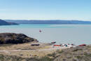
The harbour is owned by the Government of Greenland and administered by Sikuki A/S. It consists of a S-facing bay at the bottom of Kangerlussuaq (Søndre Strømfjord) between Brennan Pynt and Emmons Pynt, with quay facilities, a sea terminal for tankers and anchorage.
Pier facility: Quay length 20 m/depth 1) approx. 1.5 m/wharf height 2) approx. 1.5 m.
Sea terminal for tankers with depths of:
24-26 m 1) on the S-side of the mooring site.
Approx. 15 m 1) on the mooring site itself.
Approx. 10 m 1) on the N-side of the mooring site.
Mooring buoys anchored in approx. 60 m of water.
Seabed conditions: Clay.
1) Mean low water spring, 2) Mean high tide.
Kangerlussuaq means "the large fjord" in Greenlandic.
Refer to the harbour plan.
At the pier facility: Only small vessels from anchored ships, small landing vessels and leisure boats can enter through the dredged and marked channel (water depth about 3.0 m at mean sea level, MSL). The channel was dredged in 2016. It must be assumed that the depth decreases by approx. 0.25 m per year. Dredging is usually performed at intervals of 5-6 years.
Tidal range at spring tide is approx. 3.0 m and at neap tide approx. 1.6 m. Max. tidal range approx. 3.6 m. There is high tide in the innermost, E part of Kangerlussuaq approx. 3 hours later than at the mouth. Refer also to the Tide Tables for Greenland.
The current at the entrance and in the W part of the fjord flows NE with a rising tide, and SW with a falling tide, and it reaches a speed of up to 7 knots in this part of the fjord. Approx. 20 M further E in the fjord, the current decreases to a maximum of approx. 3 knots and at Qaqqatsiaq (midway in the fjord) to approx. 2 knots. The current can be felt up to approx. 60 M E of the entrance. Outside the entrance to the fjord, there is strong current across the mouth of the fjord, usually flowing N, which must be taken into account when approaching.
Ice-free approach period: Mid-June until the end of October, during which time the harbour can be navigated both during the day and at night.
Kangerlussuaq (Søndre Strømfjord) is filled with winter ice throughout its inner E half up to approx. 55 M SW of Kangerlussuup Umiarsualivia, which should be expected to be closed to navigation from early December until mid-June. The thickness of the winter ice can range from 5-90 cm. The average thickness is approx. 45 cm. The thickest ice is usually found on the S side of the fjord. In the winter and spring, the tide carries a lot of ice from the sea into the SW part of the fjord.
The weather in Kangerlussuup Umiarsualivia is usually best from July to October and does not usually impede the dispatch of ships. Strong winds can occur from the ice cap from directions between E and SE.
Fog rarely occurs and precipitation is light. The area has an average of approx. 10 days of fog per year. In the summer, low coastal fog can extend all the way to the mouth of the fjord.
Approach conditions and anchoring: ETA must be provided with 24 hours' notice for large ships. Tankers moor to buoys at the sea terminal approx. 700 m SSE of Emmons Pynt. The holding ground is good and consists of mud and clay.
Length of the day (approx. times):
Polar night: 16-27 December.
Midnight sun: 15 June - 1 July.
5 knots when navigating in the harbour.
This is the gateway to Greenland by aircraft.
The settlement is supplied by 2-3 calls by Atlantic ships, and a weekly call by a settlement vessel from Sisimiut.
Refer to the chart and harbour plan.
Refer to the chart and harbour plan.
Refer to chart 1411.
There is a motor boat and 2 LCM landing vessels.
Fresh water, gas oil and provisions cannot be expected.
Loading and unloading gear:
Mobile cranes with lifting capacity of up to 5 tonnes and forklift trucks. Landing vessels for loading and unloading ships moored to mooring buoys or at anchor.
Health service:
Nursing station (2 nurses) and 1 health assistant.
Transport:
There is an airport from where there are flights to the rest of Greenland and to Copenhagen.
Sikuki A/S
Telefon (+299) 31 40 30 (weekdays 8000-1600) - outside normal working hours, the phone is forwarded to the harbour office in Nuuk.
E-post: sikuki@sikuki.gl
Hjemmeside: sikuki.gl
Performed by the Customs Function from the airport and ordered through the harbour office.
It is very important to follow the leading lights into the quay, as there is very shallow water a few metres to either side.
In order to obtain mobile coverage, ships should anchor so they can see the runway.