Kujataa (Sydgrønland)
60°42,991'N 046°02,153'W - Kort 1135 - havneplanskort 1151
Kujataa (South Greenland)
60°42,991'N 046°02,153'W - Chart 1135 - harbourplan chart 1151
By
3081 indbyggere (2026)
City
3081 inhabitants (2026)
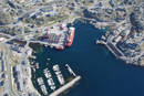
der ejes af Grønlands Selvstyre og administreres af Royal Arctic Line, består af en mod S åben bugt beskyttet af en dækmole og af følgende kajanlæg:
1. Atlantkaj: Kajlængde 98 m/ Dybde 1) 6,6 m/ Bolværkshøjde 2) 1,3 m/ Belastning 2000 kg/m².
Skonnertkaj: Kajlængde ca. 50 m/ Dybde 1) 6,8-4,4 m/ Bolværkshøjde 2) 1,3 m.
Monteringskaj: Kajlængde 18 m/ Dybde 1) ca. 3,5 m/ Bolværkshøjde 2) 1,3 m.
Fiskerikaj: Kajlængde 16 m/ Dybde 1) ca. 2,8 m/ Bolværkshøjde 2) 1,3 m.
2. En antal pontonbroer beregnet for mindre fartøjer:
N-havnen: En med ca. 4,0 m dybde 1) og en på S-siden af Monteringskaj.
W-havnen: En ca. 18 m lang oliebro md 2,5 m dybde 1). På N-siden af dækmolen findes et antal pontonbroer beregnet for fritidsbåde m.m.
Bundforhold: Mudder/klippe.
1) middelspringtidslavvande, 2) middelhøjvande.
3. Uden for havnen og 700 m SW for denne findes et tankanlæg med afmærket ankerplads for agterfortøjning. Dybde ved middelspringtidslavvande ca. 6,0 m.
Qaqortoq betyder på grønlandsk (det hvide).
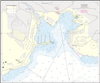
Se havneplan.
langs Atlantkaj: Længde 110 m, bredde 18 m, dybgang 6,5 m.
Flodhøjde ved springtid ca. 2,8 m, ved niptid ca. 1,4 m. Maks. flodhøjde ca. 3,5 m. Gennemsnitlig forskel mellem største springtidslavvande og største springtidshøjvande er 4,2 m. SE-lige vinde kan give ca. 2,1 m højvande og NW-lige vinde ca. 2,1 m lavvande.
Stigende vande giver idvande langs kajanlægene i havnen samt langs kysterne i bugten S for havnen. Idvandet sætter i så fald med 1-2 knob. Elvudløbet forårsager altid en svag, udgående strøm langs Skonnertkaj.
Isfri anløbsperiode: Ultimo juli - januar.
I storisperioden (maj - august) bør DMI's Istjeneste altid kontaktes. Storisen kan fra medio maj til primo august skabe store vanskeligheder for besejlingen af fjorden og havnen. Oftest er indenskærsruter i denne periode eneste besejlingsmulighed. I Qaqortuq Ikera (Julianehåbsfjord) kan kalvis, storis og isfjelde genere såvel i fjordmundingen som i fjorden samt ved havneindsejlingen til Qaqortoq (Julianehåb). Vinde fra SW, W og NW kan sætte is ind i havnen, men isen forsvinder hurtigt igen ved vejr- og tidevandsskift. På ankerpladsen kan der stå en voldsom isgang. I ekstremt kolde vintre kan der dannes vinteris i fjorden og havnen.
Den vind, som forekommer oftest i Qaqortoq (Julianehåb), er Sydosten, der i havn og på ankerpladser blæser fra E- og NE-lig retning. Som egentlig storm forekommer den hyppigt i vintermånederne og som stiv kuling om sommeren. Sydosten kendetegnes ved, at temperaturen stiger stærkt. Vindstødene kan blive meget voldsomme. Næst efter Sydosten er Norden den kraftigste vind, der blæser fra NW til WNW. Den kastes gennem det dybe dalstrøg langs den store ferskvandssø og blæser fra W-siden af elven tværs over havnen. Sydvesten er en vind, der blæser fra S. Den er sjælden ved Qaqortoq, men kan dog forekomme. Sydvesten er den farligste, idet den sætter en voldsom sø og dønning ind i havnen.
forekommer hyppigt i storisperioden (maj - august). SE-lig vind giver nedbør og ringe sigtbarhed.
Havnen kan besejles både dag og nat.
Anløbsforhold og ankring:
ETA gives for store skibes vedkommende med 24 timers varsel. Der kan ankres for svaj ca. 300 m S for dækmolen i skæringspunktet mellem de 2 sæt grønne ankermærkefyr. Holdebunden er ikke god. Dog er holdebunden god i skæringspunktet for ankermærkebåkerne ud for tankanlægget (ca. 700 m SW for havnen).
Dagens længde (ca. tider):
Korteste dag: 0900-1500.
Længste dag: 0200-2300.
Største tilladte fart er 3 knob eller sikker styrefart.
Qaqortoq er hovedbyen i Sydgrønland med dertil hørende institutioner så som gymnasium og andre vidergående uddannelser.
Byen anløbes af en del krydstogtsskibe heraf mange store med op til 3000 passagerer.
Se kort og havneplan.
Se kort og havneplan.
Nødankerpladser: Der kan ankres i vigen E for øen Matu. Dybden på ankerpladsen er ca. 40 m. Holdebunden er god og består af sand. Der er læ for alle vinde. Store skibe kan med fordel ankre i bugten ud for Eqalugaarsuit på ca. 50 m vand. Holdebunden er god og består af ler. Der er læ for E-, S- og W-lige vinde
Se siden om lods.
Ingen. Politikutter kan eventuelt anvendes, hvis den er i havnen.
Ferskvand kan leveres fra vandledning (ca. 20 tons/time) ved Atlantkaj, Skonnertkaj og Fiskerikaj. Ferskvand skal inden ankomst bestilles hos havneforvalteren. Gasolie og smøreolie fås kun efter aftale inden ankomst. Flaskegas i begrænsede mængder og alene i 2½, 5 og 10 kg flasker. Møntvaskeri. Proviant kun i begrænset mængde. Værksteder for alle reparationer. Dykkerassistance. Der findes tankresningsanlæg og olieseparationsanlæg. Midler til bekæmpelse af olieforurening i begrænset omfang.
250 tons beddingsanlæg. Monteringskaj med 35 tons derrick-kran samt ophalerbedding til skibe med en længde på ca. 11 m.
Elforsyning: 220 V ved Atlant- og Skonnertkaj. Kun til skibe hjemmehørende i Qaqortoq (Julianehåb).
Losse- og lastegrej:
Havnen råder over diverse materiel til container- og godshåndtering. Der kan rekvireres kranassistance fra byen.
Sundhedsvæsen:
Regionssygehus med læger, sygeplejersker og tandlæge samt apotekervarer.
Transport
Der er en heliport med daglig forbindelse til lufthavnen i Narsarsuaq.
Konsulat: Letland.
Royal Arctic Line
Telefon (+299) 49 44 39 (døgnvagt)
Telefon (+299) 64 16 33
Telefax (+299) 64 16 32
E-post: eti@ral.gl
VHF (Indenfor normal arbejdstid kan havnen kontaktes på kanal 16)
Qaqortoq Tele-Post Center
Standardordensreglement er gældende.
Naalakkersuisut er central overordnet havne- og ISPS myndighed i Grønland. Royal Arctic Line er lokal funktionel havnemyndighed og ISPS ansvarlig for havnefaciliteter i Qaqortoq (Julianehåb).
The harbour is owned by the Government of Greenland and is administered by Royal Arctic Line. It consists of a bay that is open to the S and is protected by a breakwater. It also has the following quay facilities:
1. Atlantkaj: Quay length 98 m/depth 1) 6.6 m/wharf height 2) 1.3 m/load 2,000 kg/m².
Skonnertkaj: Quay length approx. 50 m/depth 1) 6.8-4.4 m/wharf height 2) 1.3 m.
Monteringskaj: Quay length 18 m/depth 1) 3.5 m/wharf height 2) 1.3 m.
Fiskerikaj: Quay length 16 m/depth 1) 2.8 m/wharf height 2) 1.3 m.
Gl. kulkaj: Quay length 6 m/depth 1) 0.5 m/wharf height 2) 1.3 m.
2. A number of pontoon bridges intended for smaller vessels:
N-harbour: One with approx. 4.0 m depth 1) and one on the S side of Monteringskaj.
W-harbour: One approx. 18 m long oil pier with 2.5 m depth 1). On the N side of the breakwater, there are a number of pontoon bridges intended for leisure boats, etc.
Seabed conditions: Mud/rock.
1) Mean low water spring, 2) Mean high tide.
3. Outside the harbour and 700 m SW of it, there is a tank installation with buoyed anchorage for stern-mooring. The depth at mean low water spring is about 6.0 m.
Qaqortoq means "the white" in Greenlandic.
Refer to the harbour plan.
Along Atlantkaj: Length 110 m, width 18 m, draught 6.5 m.
Tidal range at spring tide is approx. 2.8 m and at neap tide approx. 1.4 m. Max. tidal range approx. 3.5 m. Average difference between largest spring low water and largest spring high water is 4.2 m. SE winds can produce approx. 2.1 m high water and NW winds approx. 2.1 m low water.
Rising waters produce a coastal countercurrent alongside the quay facilities in the harbour and along the coasts in the bay S of the harbour. The coastal countercurrent then flows at 1-2 knots. The river mouth always causes a weak, outgoing current along Skonnertkaj.
Ice-free approach period: End of July - January.
The DMI Iceservice should always be contacted during the polar ice season (May-August). From mid-May to early August, the polar ice can cause major difficulties for navigation of the fjord and the harbour. The inshore routes are usually the only navigation option during this period. In Qaqortuq Ikera (Julianehåbsfjord), bergy bits, polar ice and icebergs can obstruct the mouth of the fjord and the fjord itself, as well as the harbour entrance to Qaqortoq (Julianehåb). Winds from SW, W and NW can push ice into the harbour, but the ice quickly disappears again when the weather and tide change. There can be strong ice drift at the anchorage. Winter ice can form in the fjord and in the harbour in extremely cold winters.
The wind that occurs most frequently in Qaqortoq (Julianehåb) is a Southeaster, which blows from E and NE in the harbour and at anchorages. It often occurs as an actual storm during the winter months and as a moderate gale in the summer. A Southeaster is characterised by the fact that the temperature rises sharply. The gusts of wind can be very violent. Next to a Southeaster, a north wind is the strongest and blows from NW to WNW. Gusts blow through the deep valley along the large freshwater lake and blow from the W side of the river across the harbour. A Southwester is a wind that blows from S. It is rare at Qaqortoq, but it can occur. A Southwester is the most dangerous, because it causes violent seas and a strong swell in the harbour.
Fog occurs frequently during the polar ice season (May - August). SE winds produce precipitation and poor visibility.
The harbour can be navigated during both the day and night.
Approach conditions and anchoring:
ETA for large ships must be given with 24 hours' notice. It is possible to sway at anchor approx. 300 m S of the breakwater at the intersection of the 2 sets of green anchor buoys. The holding ground is not good. However, the holding ground is good at the intersection of the anchor mark beacons off the tank facility (about 700 m SW of the harbour).
Length of the day (approx. times):
Shortest day: 09:00-15:00.
Longest day: 02:00-23:00.
The maximum speed permitted is 3 knots or safe manoeuvre speed.
Qaqortoq is the main town in South Greenland, with associated institutions such as an upper secondary school and other higher education facilities.
The town is visited by a number of cruise ships, many of which are large with up to 3000 passengers.
Refer to the chart and harbour plan.
Refer to the chart and harbour plan.
Emergency anchorage: It is possible to anchor in the cove E of the island of Matu. The depth at the anchorage is approx. 40 m. The holding ground is good and consists of sand. There is shelter from all winds. Large ships are recommended to anchor in the bay off Eqalugaarsuit in approx. 50 m of water. The holding ground is good and consists of clay. There is shelter from E, S and W winds.
See the page about pilots.
None. A police cutter may be used if it is in the harbour.
Fresh water can be supplied from the water pipeline (approx. 20 tonnes/hour) at Atlantkaj, Skonnertkaj and Fiskerikaj. Fresh water must be ordered from the harbour manager before arrival. Gas oil and lubricating oil are only available by agreement before arrival. Bottled gas in limited quantities and only in 2½, 5 and 10 kg bottles. Laundromat. Provisions are only available in limited quantities. Workshops for all repairs. Diver assistance. There are tank cleaning facilities and oil separation facilities. Means to combat oil pollution to a limited extent.
250 tonnes slipway facility. Monteringskaj with 35-tonne derrick crane and slipway for ships with a length of approx. 11 m.
Electricity supply: 220 V at Atlantkaj and Skonnertkaj. Only for ships based in Qaqortoq (Julianehåb).
Loading and unloading gear:
The harbour has various equipment available for container and freight handling. Crane assistance can be requested from the town.
Health service:
Regional hospital with doctors, nurses and dentists, as well as pharmacy products.
Transport
There is a heliport with daily connection to the airport in Narsarsuaq.
Consulate: Latvia.
Royal Arctic Line
Telephone (+299) 49 44 39 (24-hour service)
Telephone (+299) 64 16 33
Telefax (+299) 64 16 32
E-mail: eti@ral.gl
VHF (The harbour can be contacted on channel 16 during normal working hours)
Qaqortoq Tele-Post Centre