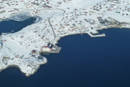
Kujataa (Sydgrønland)
60°54,369'N 046°02,901'W - Kort 1116 - havneplanskort 1151
Kujataa (South Greenland)
60°54,369'N 046°02,901'W - Chart 1116 - harbourplan chart 1151
By
1241 indbyggere (2026)
City
1241 inhabitants (2026)
der ejes af Grønlands Selvstyre og administreres af Royal Arctic Line, består af:
1. En S-vendt bugt, Fabriksbugten, ud mod Narsap Ikerasaa (Narsaq Sund) og en ankerplads med 20-35 m dybde midt i bugten samt følgende kajanlæg:
Atlantkaj: Kajlængde 60 m/ Dybde 1) 8,3 m/ Bolværkshøjde 2) 3 m/ Belastning 2000 kg/m².
Skonnertkaj: Kajlængde 30 m/ Dybde 1) 2,8-6,5 m/ Bolværkshøjde 2) 1,5 m/ Belastning 2000 kg/m².
Oliebro: Kajlængde 5 m/ Dybde 1) 2,0-3,0 m/ Bolværkshøjde 2) 1,5 m.
Pontonbro: Kajlængde 6 m/ Dybde 1) ca. 1,5 m.
2. En SW-vendt bugt, Kolonibugten, ud nod Narsap Ikerasaa (Narsaq Sund) med ankerplads på 8-2 m dybde og en ankerkæde tværs over bugten i den NE-lige del samt en 6 m lang pontonbro i bunden af bugten.
Bundforhold: Klippe/mudder.
1) middelspringtidslavvande, 2) middelhøjvande.
Narsaq betyder på grønlandsk (slette).
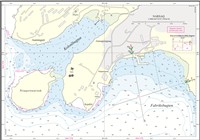
Se havneplan.
langs Atlantkaj: Længde 205 m, bredde 26 m, dybgang 7,5 m.
Flodhøjde ved springtid ca. 4,40 m, ved niptid ca. 2,20 m. Maks. flodhøjde ca. 3,6 m. SW-lige vinde kan give 0,2-0,3 m over daglig vande, mens NE-lige vinde kan give indtil 0,3 m under daglig vande.
I Fabriksbugt er der hovedsagelig tidevandsstrøm, som følger bugtens kyst og kan sætte stærkt omkring springtid. Ved kajanlæggene mærkes strømmen som idvande.
Isfri anløbsperiode: Marts - februar.
I storisperioden bør DMI's Istjeneste altid kontaktes. Storisen kan ligge tæt og på land i Julianehåb Bugt og via Narlunaq (Skovfjord) ligge ind forbi havnen og i Narsap Saava (Narsaq Sund). Ikersuaq (Bredefjord) kan også i den W-lige halvdel være fyldt med storis. Bræis fra Sermilik (Nordre Sermilik) kan ofte blokere Narsap Ikerasaa (Narsaq Sund) og endog trænge SW-over i både Ikersuaq (Bredefjord) og Narlunaq. Dette sidste især i forbindelse med spring- og niptid, der også forårsager isgang i Narsap Ikerasaa (Narsaq Sund). Det er sjældent, at både Ikersuaq (Bredefjord) og Narlunaq (Skovfjord) er fyldt med is på samme tid, hvilket også gælder for fjordmundingerne. I Narsap Ikerasaa (Narsaq Sund) ligger altid is, ligesom isbjerge og skosser er til gene for anløb af havnen og kan ligge strandet på ankerpladsen i Fabriksbugten samt ud for Atlantkaj, hvor Sydosten og S-lig kuling kan give isgang og -pres til besvær for skibe langs kajerne. Som regel ligger vinterisen fra februar til marts. I ekstremt kolde vintre kan 40-65 cm tyk vinteris ligge i Fabriksbugten, i Narlunaq (Skovfjord) 10-15 cm tyk, i Ikersuaq (Bredefjord) 7-10 cm tyk samt i Narsap Ikerasaa (Narsaq Sund) 35-50 cm tyk. Årsagen til, at vinterisen i Narsap Ikerasaa (Narsaq Sund) opnår en væsentlig større tykkelse end isen i de 2 tilstødende fjorde, er, at de i sundet altid tilstedeværende isskosser yder et sådant vindlæ, at isdannelsen ikke hæmmes.
Den vind, der forekommer oftest i Narsaq, er fønvinden Sydosten, som ledsages af orkanagtige fjeldkast fra Narsap Qaqqaa (Narsaq Fjeld). Den såkaldte Norden er en vind, der blæser fra NW til N. Norden er ikke så voldsom som Sydosten. Sydvesten blæser sjældent ved Narsaq. Sydvesten er den farligste af dem alle, dels fordi den opstår uden forudgående varsel, dels fordi den sætter en voldsom sø og dønning ind i såvel Fabriksbugten som Kolonibugten med svære skader på skibe/både i havnen til følge.
forekommer ofte i storisperioden (maj - august) samt i tilfælde, hvor Narssaq Ikerasaa (Narsaq Sund) er fyldt op af bræis. Se-lige vinde giver nedbør og ringe sigtbarhed.
Fabriksbugten kan besejles både dag og nat. Kolonibugten kun om dagen.
Anløbsforhold og ankring:
ETA gives med 24 timers varsel for store skibes vedkommende. Større skibe bør ikke komme for N-lig ved Atlantkaj, da der er grundt ud for fortøjningsstablen umiddelbart N for kajen. W for Skonnertkaj findes skær med kun 0,8 m vanddybde. Ankerpladsen i Fabriksbugten, hvor holdebunden er ringe, er ikke sikker liggeplads med vindstyrker over 17 m/sek.
Dagens længde (ca. tider):
Korteste dag: 0900-1500.
Længste dag: 0200-2300.
Største tilladte fart er 3 knob eller sikker styrefart.
Se havneplan.
Se havneplan.
Se havneplan.
Se havneplan.
Nødankerpladser: Der kan ankres i vigen E for Matu. Dybden på ankerpladsen er ca. 40 m. Holdebunden er god og består af sand. Der er læ for alle vindretninger. Større skibe kan med fordel ankre i bugten ud for Eqalugaarsuit på ca. 50 m vand. Holdebunden er god og består af ler. Der er læ for E-, S- og W-lige vindretninger.
Ferskvand leveres i sommerhalvåret fra vandledning ved Atlantkaj. Gasolie leveres efter aftale med havnemyndighederne. Ingen smøreolie. Flaskegas og proviant i begrænsede mængder. Kran til optagning af både på max. 5 tons. Værksteder for alle reparationer. Dykkerassistance skal rekvireres fra Qaqortoq (Julianehåb).
Losse- og lastegrej:
Havnen råder over diverse materiel til container- og godshåndtering.
Sundhedsvæsen:
Sundhedscenter, læge, sygeplejersker og tandlæge samt apotekervarer. Mulighed for anskaffelse og supplering af "medicinkiste".
Transport
Der er heliport i byen med forbindelse til lufthavnen i Narsarsuaq.
Royal Arctic Line
Telefon (+299) 49 72 33 (døgnvagt)
Telefon (+299) 66 49 60
Telefax (+299) 66 16 32
E-post: mael@ral.gl
VHF (Indenfor normal arbejdstid kan havnen kontaktes på kanal 16.)
Narsaq Tele-Post Center
Standardordensreglement er gældende.
Naalakkersuisut er central overordnet havne- og ISPS myndighed i Grønland. Royal Arctic Line er lokal funktionel havnemyndighed og ISPS ansvarlig for havnefaciliteter i Narsaq.
The harbour is owned by the Government of Greenland and is administered by Royal Arctic Line. It consists of:
1. A S-facing bay, Fabriksbugten, out towards Narsap Ikerasaa (Narsaq Sund) and an anchorage with 20-35 m depth in the middle of the bay. It also has the following quay facilities:
Atlantkaj: Quay length 60 m/depth 1) 8.3 m/wharf height 2) 3 m/load 2,000 kg/m².
Skonnertkaj: Quay length 30 m/depth 1) 2.8-6.5 m/wharf height 2) 1.5 m/load 2,000 kg/m2.
Oliebro: Quay length 5 m/depth 1) 2.0-3.0 m/wharf height 2) 1.5 m.
Pontoon bridge: Quay length 6 m/depth 1) approx. 1.5 m.
2. A SW-facing bay, Kolonibugten, out towards Narsap Ikerasaa (Narsaq Sund) with an anchorage of 8-2 m depth and an anchor chain across the NE part of the bay. There is also a 6 m long pontoon bridge at the bottom of the bay.
Bottom conditions: Rock/mud.
1) Mean low water spring, 2) Mean high tide.
Narsaq means "plains" in Greenlandic.
Refer to the harbour plan.
Along Atlantkaj: Length 205 m, width 26 m, draught 7.5 m.
Tidal range at spring tide approx. 4.40 m, at neap tide approx. 2.2 m. Max. tidal range approx. 3.6 m. SW winds can produce water 0.2-0.3 m above mean sea level, while NE winds can produce water up to 0.3 m below mean sea level.
In Fabriksbugt, there is mainly a tidal current that follows the coast of the bay and can become strong around spring tide. The current manifests itself as coastal counter current at the quay facilities.
Ice-free approach period: March - February.
The DMI Ice Service should always be contacted during the polar ice season. The polar ice can be close to and on the coast in Julianehåb Bugt and it passes through Narlunaq (Skovfjord) past the harbour and into Narsap Saava (Narsaq Sund). The W half of Ikersuaq (Bredefjord) can also be filled with polar ice. Glacial ice from Sermilik (Nordre Sermilik) can often block Narsap Ikerasaa (Narsaq Sund) and even penetrate SW into both Ikersuaq (Bredefjord) and Narlunaq. The latter occurs especially in connection with spring and neap tide, which also causes ice drift in Narsap Ikerasaa (Narsaq Sund). It is rare that both Ikersuaq (Bredefjord) and Narlunaq (Skovfjord) are filled with ice at the same time, which also applies to the mouths of the fjords. There is always ice in Narsap Ikerasaa (Narsaq Sund) and icebergs and floes are an obstruction to calling at the harbour and can be stranded at the anchorage in Fabriksbugten, as well as off Atlantkaj, where Southeasters and gales from S can cause ice drift and ice under pressure, which in turn can cause difficulties for ships along the quays. The winter ice usually occurs from February to March. In extremely cold winters, 40-65 cm thick winter ice can be found in Fabriksbugten, 10-15 cm thick in Narlunaq (Skovfjord), 7-10 cm thick in Ikersuaq (Bredefjord) and 35-50 cm thick in Narsap Ikerasaa (Narsaq Sund). The reason why the winter ice in Narsap Ikerasaa (Narsaq Sund) reaches a considerably greater thickness than the ice in the 2 adjoining fjords is that the growlers that are constantly present in the sound provide so much wind shelter that ice formation is not prevented.
The wind that occurs most often in Narsaq is the Southeaster Foehn wind, which is accompanied by hurricane-like mountain gusts from Narsap Qaqqaa (Narsaq Fjeld). The so-called "Norden" is a wind that blows from NW to N. This north wind is not as violent as Southeaster. Southeasters rarely occur at Narsaq. A Southwester is the most dangerous of all, partly because it arises without prior warning, partly because it causes a strong swell in both Fabriksbugten and Kolonibugten, which can result in severe damage to ships/boats in the harbour.
Fog often occurs during the polar ice season (May - August) and at times when Narssaq Ikerasaa (Narsaq Sund) is filled with glacial ice. SE winds produce precipitation and poor visibility.
Fabriksbugten can be navigated during both the day and night. Kolonibugten only during the day.
Approach conditions and anchoring:
ETA must be provided with 24 hours notice for large ships. Larger ships should not get too far N at Atlantkaj, as the water is shallow off the mooring berth immediately N of the quay. There are rocks W of Skonnertkaj at a water depth of only 0.8 m. The anchorage in Fabriksbugten, where the holding ground is poor, is not a safe berth when the wind force exceeds 17 m/sec.
Length of the day (approx. times):
Shortest day: 09:00-15:00.
Longest day: 02:00-23:00.
The maximum permitted speed is 3 knots or manoeuvring speed.
Refer to the harbour plan.
Refer to the harbour plan.
Refer to the harbour plan.
Emergency anchorage: It is possible to anchor in the cove E of Matu. The depth at the anchorage is approx. 40 m. The holding ground is good and consists of sand. There is shelter from all wind directions. Larger ships are advised to anchor in the bay off Eqalugaarsuit in approx. 50 m of water. The holding ground is good and consists of clay. There is shelter from winds from E, S and W.
Fresh water is delivered during the summer months from a water pipe at Atlantkaj. Gas oil is delivered by agreement with the harbour authorities. No lubricating oil. Bottled gas and provisions in limited quantities. Crane for lifting boats of max. 5 tonnes. Workshops for all repairs. Diver assistance must be requested from Qaqortoq (Julianehåb).
Loading and unloading gear:
The harbour has various equipment available for container and cargo handling.
Health service:
Health centre, doctor, nurses and dentist, as well as pharmacy products. Possibility of procurement and supplementation of "medicine chest".
Transport:
There is a heliport in the town with a connection to the airport in Narsarsuaq.
Royal Arctic Line
Telephone (+299) 49 72 33 (24-hour service)
Telephone (+299) 66 49 60
Telefax (+299) 66 16 32
E-mail: mael@ral.gl
VHF (The harbour can be contacted on channel 16 during normal working hours)
Narsaq Tele-Post Center